Using AI and LiDAR Annotation to Reduce Road Gridlock
The problem of traffic congestion in road transportation has become an important real-time transportation problem in countries all over the world. Assessing and eliminating this problem requires the application of efficient AI transportation technologies, which have been introduced and have been effective at least to some extent in the last few years. Transportation plays an imperative role in peoples’ everyday lives, and nowadays, the rate at which the human population is increasing and also the massive migration of people from rural to urban is threatening road infrastructures in metropolitan cities.
According to the INRIX report, traffic congestion costs each American 97 hours and $1,348 a year. New York City is the slowest U.S. city, with ‘last mile speeds of 9 MPH, meaning it is faster to bike than drive or takes the bus. Today we will take a look at AI technology that can help reduce the congestion on the roads and the data annotation that’s required to create it.
What Causes Road Gridlock?
Higher levels of urbanization, population growth, and changes in population density are the main factors that contribute to challenges facing road transportation systems. Not only do these factors delay the infrastructural development of the cities, but they also result in car accidents, traffic congestion, and an increase in travel times, fuel consumption, and carbon emanations. Having said this, studies as far back as 2011 have shown that gridlock can occur even if there are relatively few cars on the road. The culprit? Someone in the line of traffic near a light signal slows down, triggering a chain of events that can reduce the speed of all traffic behind it, build up successively longer lines of vehicles with every green-yellow-red cycle, and eventually lead to gridlock.
Another thing we need to keep in mind is that new technology is that new road-based technology is being developed, such as AI-powered last-mile delivery systems. The infrastructure of a lot of cities in the U.S. and the world, for that matter, was not built with all of these technologies in mind. This is why it is important to use AI to help us solve these problems.
How Can AI Technology Help Reduce Gridlock?
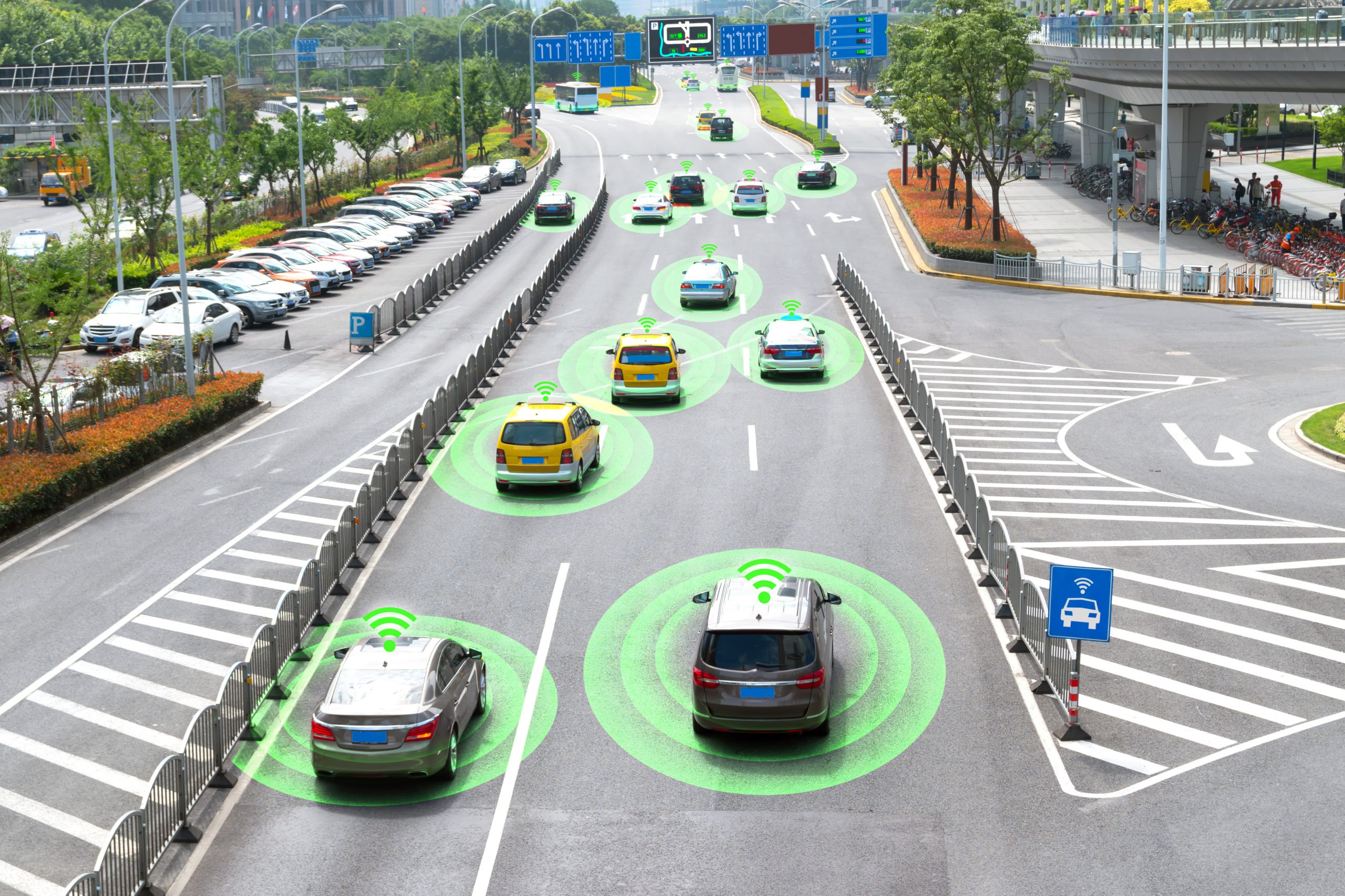
Many new technology solutions are enabling these new traffic management paradigms. These include LiDAR sensors for granular 3D road and smart spaces intelligence; dynamic/mandatory routing algorithms; AI-based edge compute enabling immediate, local, and automated response solutions such as (cooperative) adaptive traffic lights and pedestrian alerts; and V2X and 5G connectivity driving new traffic prioritization services such as premium vehicle preemption for delivery and logistics providers.
The benefits of traffic monitoring, management, and modeling/simulation extend far beyond the primary traffic flow and safety objectives. They include operational efficiencies and support for urban planning, enabling more attractive transit and, ultimately, better sustainability by reducing emissions and air quality improvement. Investing in traffic management technology is becoming an integral part of a holistic urban asset management strategy for city governments.
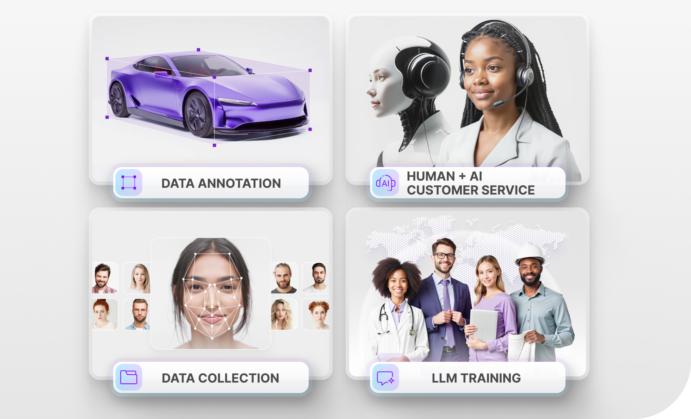
What Types of Data Annotation are Required to Create Such Technology?
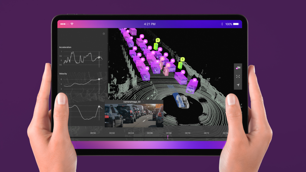
LiDAR (Light Detection and Ranging) sends out beams of light that bounce off objects and return back to the LiDAR. This is what separates it from more commonly used technologies like sonar since it measures the time of flight (ToF) of a pulsed laser to gather three-dimensional, real-time information about the physical world. Utilizing the innovative sensing technology of LiDAR combined with the rich and diverse traffic information provided by LiDAR enables smart cities to better manage traffic control platforms, make more optimized decisions, and find problems in the early stages of urban traffic congestion. Early detection of potential risks that impact traffic safety help cities improve the efficiency and safety of the road network.
Having said this, LiDAR requires extensive data annotation work to be done since it produces a 3D Point Cloud, which is a digital representation of how an AI system sees the physical world. Data annotators would need to label all of the objects in the 3D Point Cloud for the AI system to recognize all of the surrounding objects and their proximity to the LiDAR.
Trust Mindy Support to Handle All of Your Data Annotation Work
Mindy Support is a global company for data annotation and business process outsourcing, trusted by several Fortune 500 and GAFAM companies, as well as innovative startups. With nine years of experience under our belt and offices and representatives in Cyprus, Poland, Romania, The Netherlands, India, and Ukraine, Mindy Support’s team now stands strong with 2000+ professionals helping companies with their most advanced data annotation challenges.