Geospatial Data Annotation for Advanced Geographic Modeling
We can help you build AI models that
provide critical and actionable data for your business.


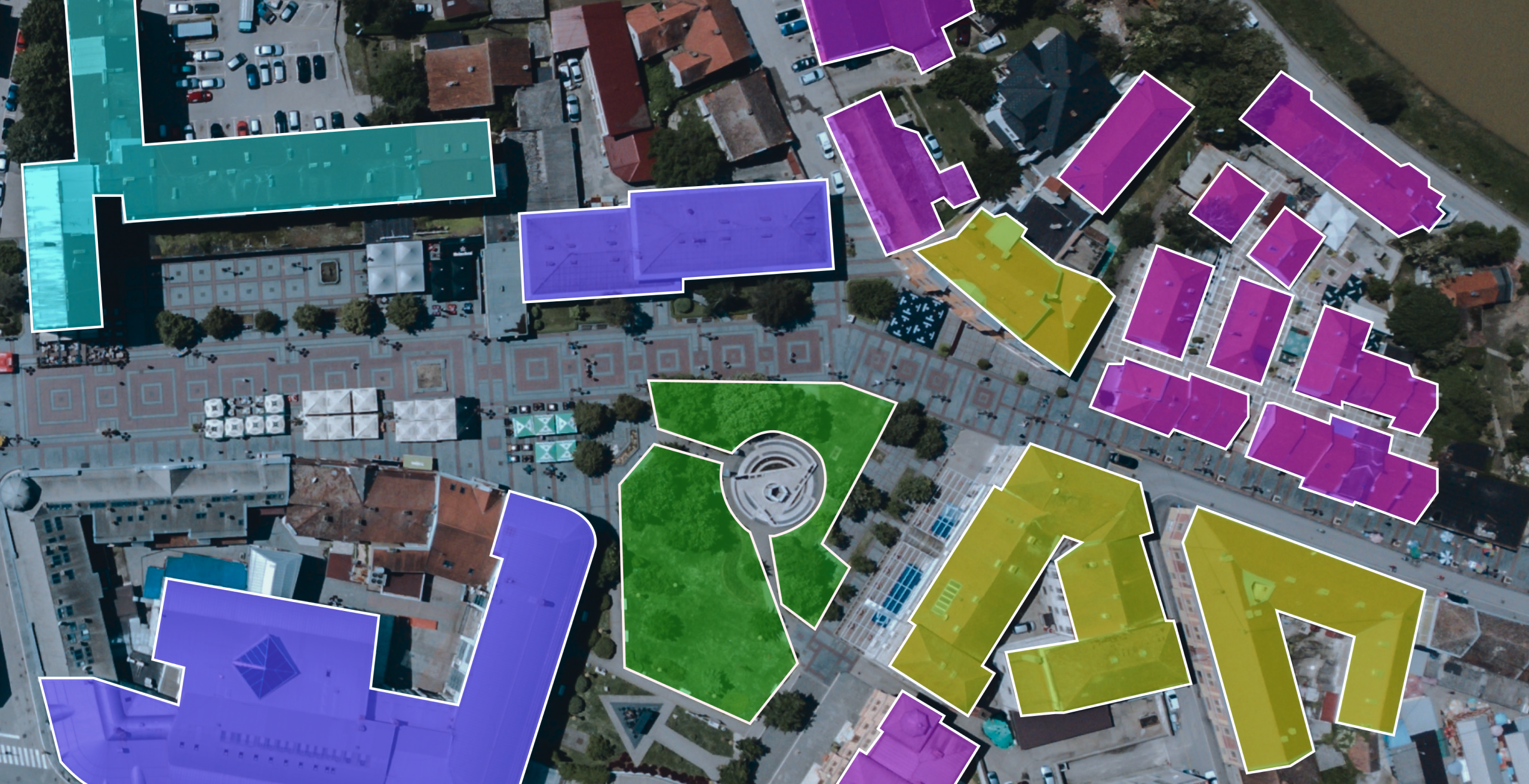
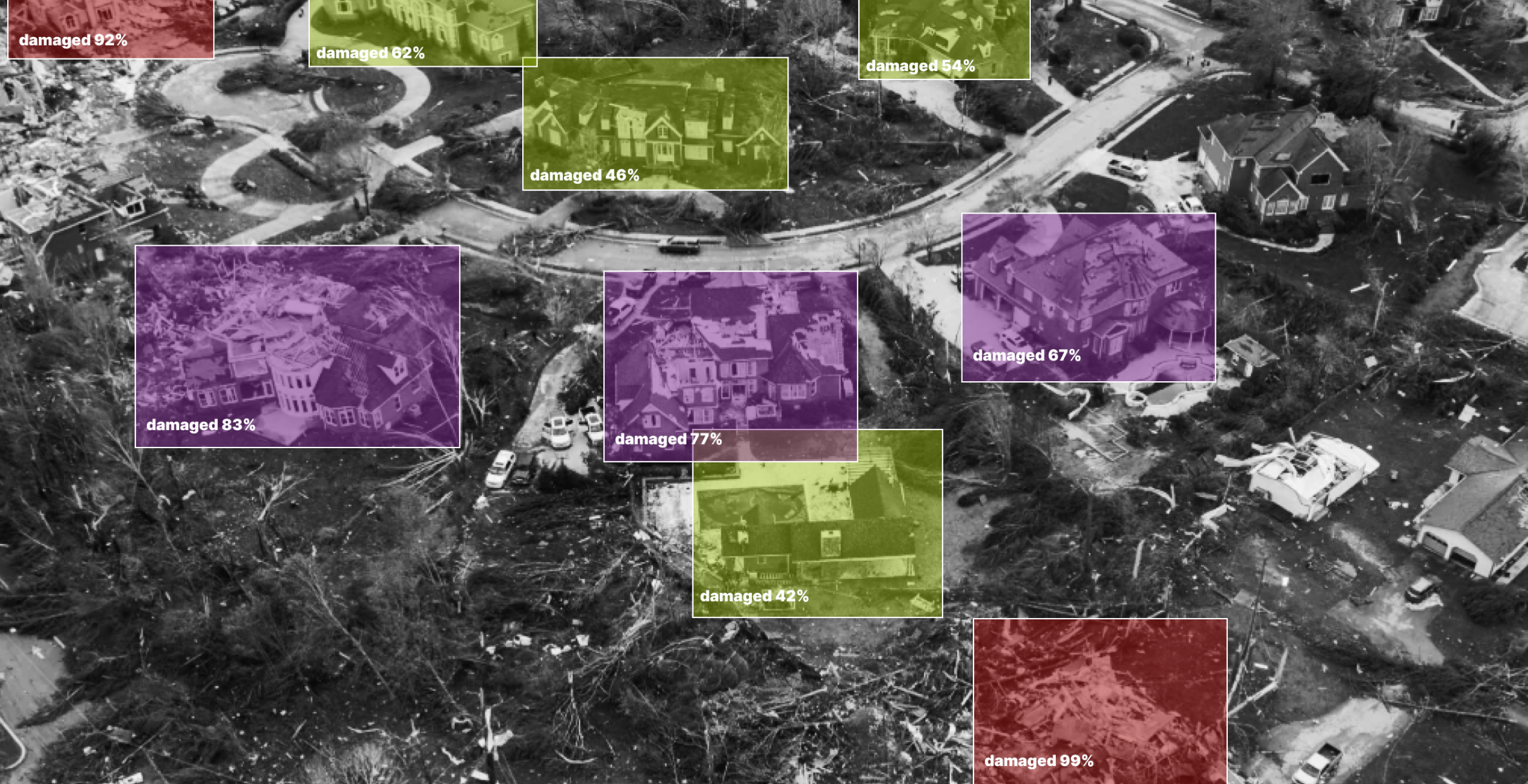
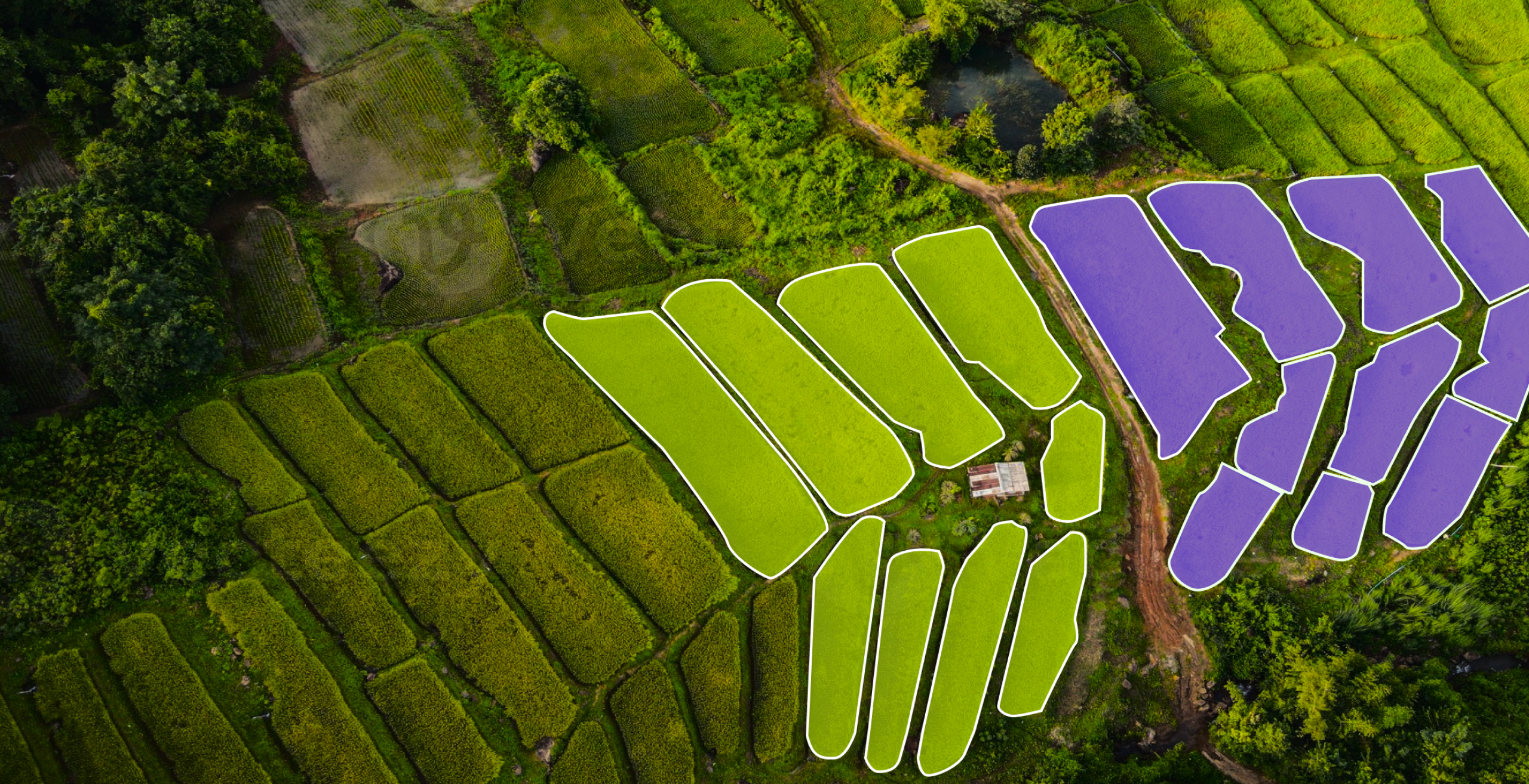
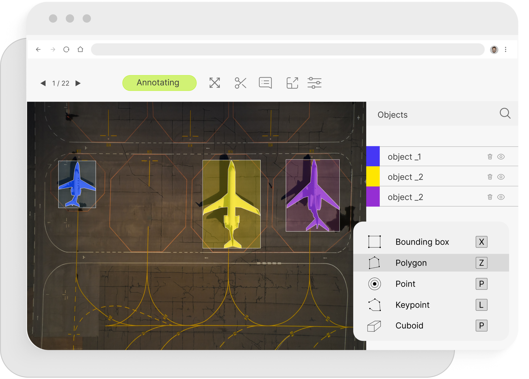
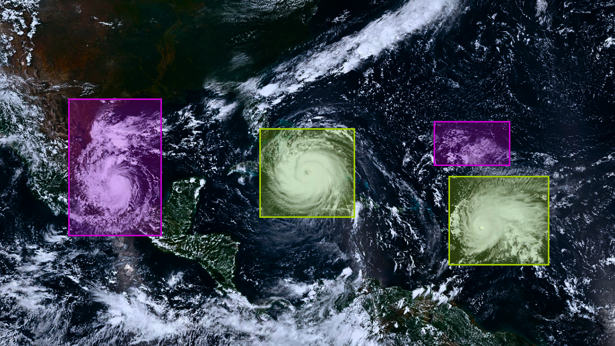
Geospatial Annotation Examples


What We Offer
Mindy Support can help you unlock the full potential of your AI projects with our high-quality annotation services, ensuring precise and reliable training data for superior model performance. This includes services like:
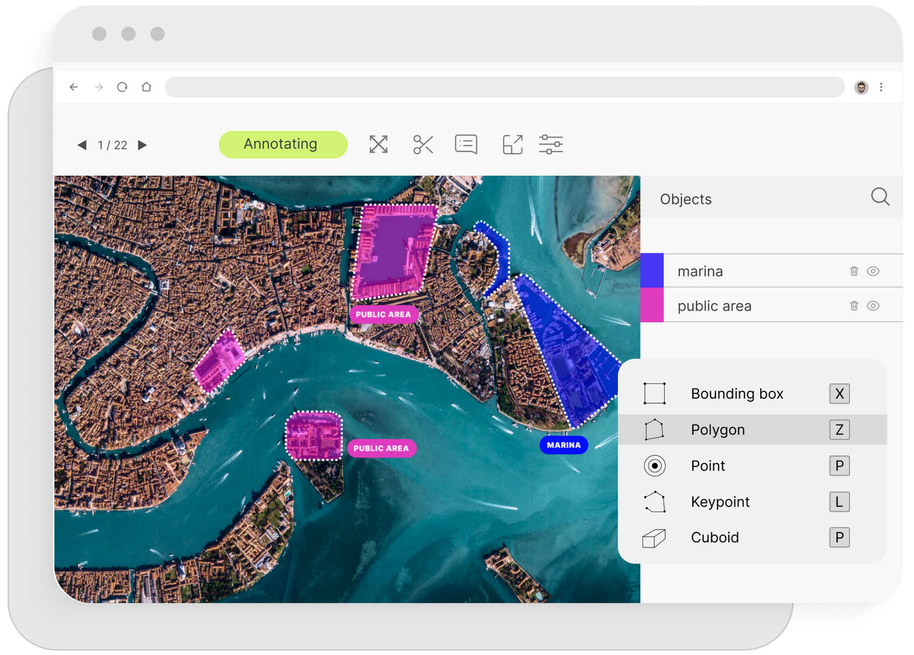
Polygon Annotation
We offer precise polygon annotation services for geospatial data, enabling accurate mapping and land use classification. Our services help train AI models for tasks such as boundary detection, terrain analysis, and object localization in satellite imagery, improving the accuracy and effectiveness of geographic information systems (GIS).
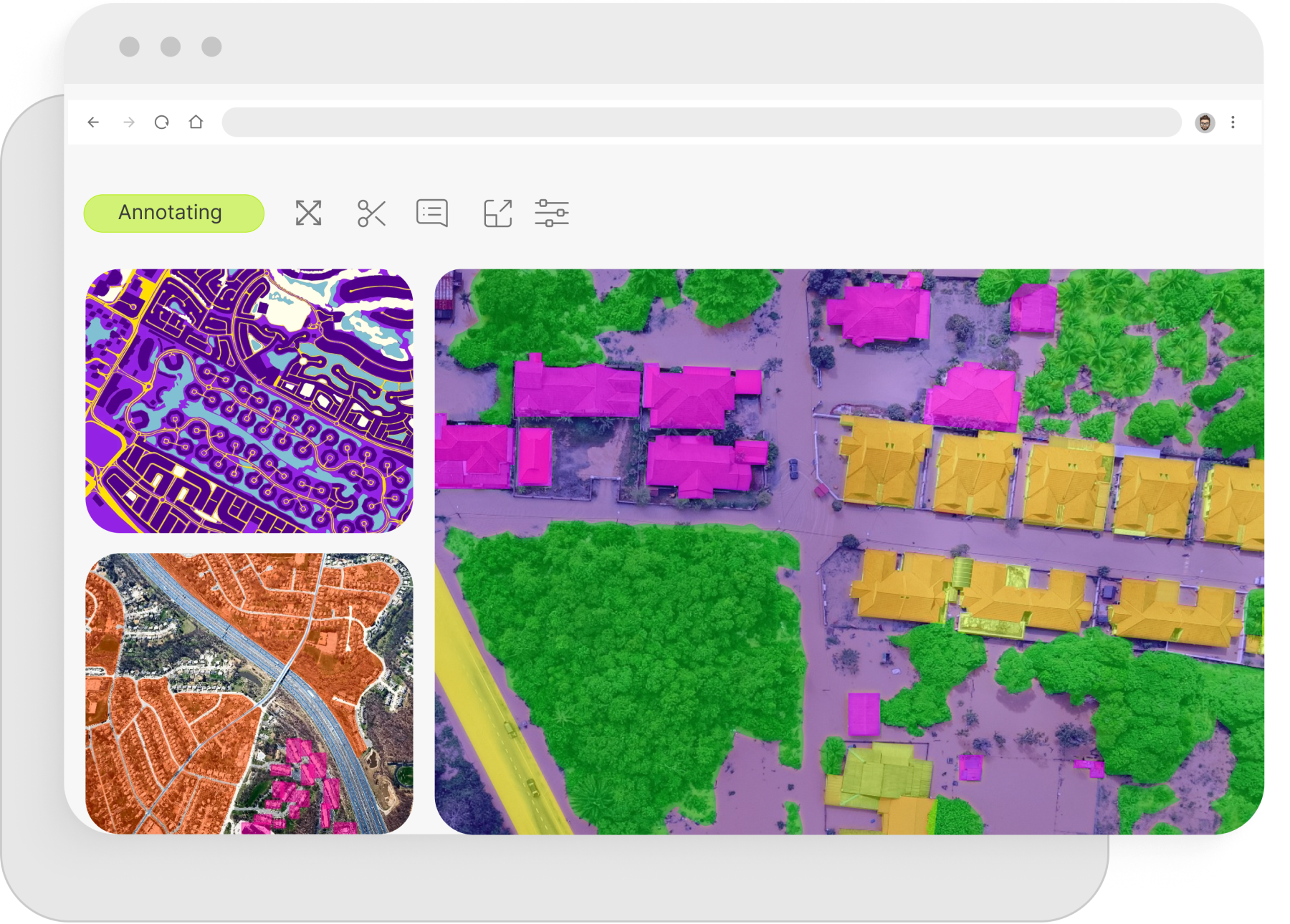
Semantic Segmentation
We provide advanced semantic segmentation services for geospatial data, allowing for detailed classification of elements within satellite or aerial imagery. This enables AI models to differentiate between land types, infrastructure, and natural features with high precision, enhancing applications like urban planning, environmental monitoring, and resource management.
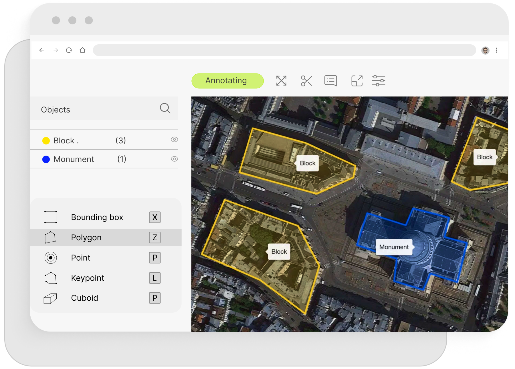
Image Classification
We offer expert image classification services for geospatial annotation, enabling accurate identification and categorization of features in satellite or aerial imagery. Our services help train AI models for land cover classification, resource mapping, and environmental monitoring, improving decision-making and analysis in geographic information systems (GIS).
Object Tracking
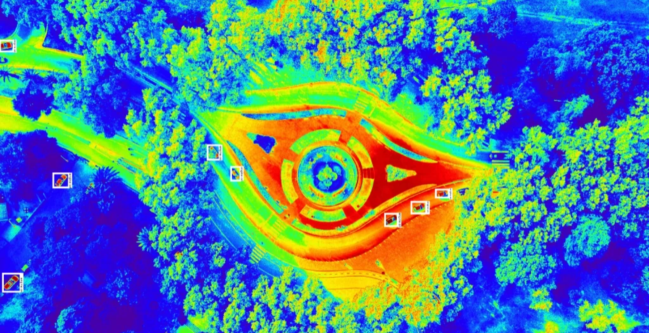
We provide specialized object tracking services for geospatial annotation, allowing for the monitoring and movement analysis of objects in satellite or aerial imagery. Our precise tracking solutions help enhance AI models used in applications such as traffic management, wildlife monitoring, and surveillance, enabling more accurate and actionable insights in geospatial systems.
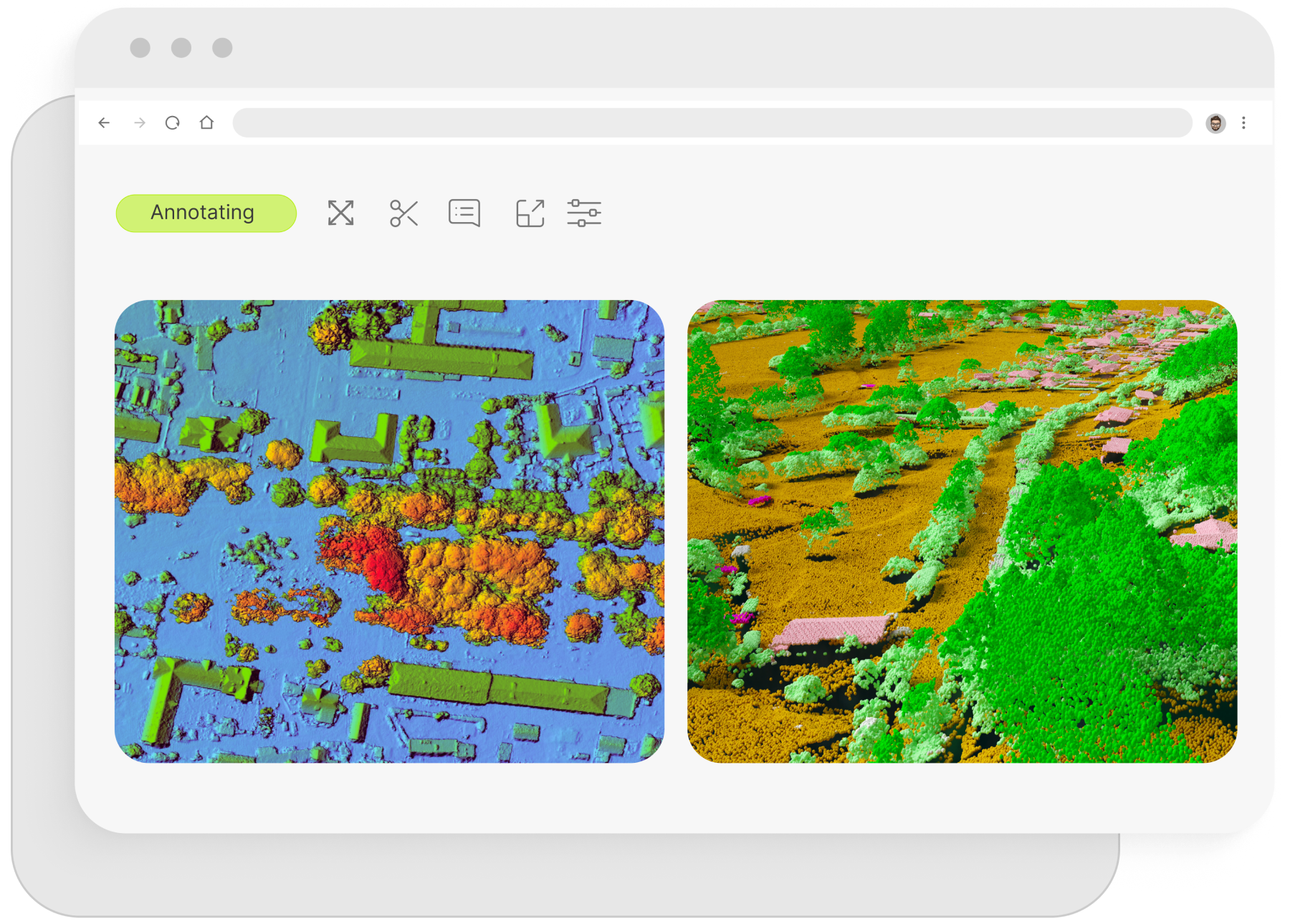
LiDAR Annotation
We offer high-quality LiDAR annotation services for geospatial data, enabling accurate 3D mapping and terrain analysis. Our precise labeling of LiDAR point clouds helps train AI models for tasks such as elevation modeling, vegetation analysis, and urban planning, improving the accuracy and efficiency of geographic and environmental systems.
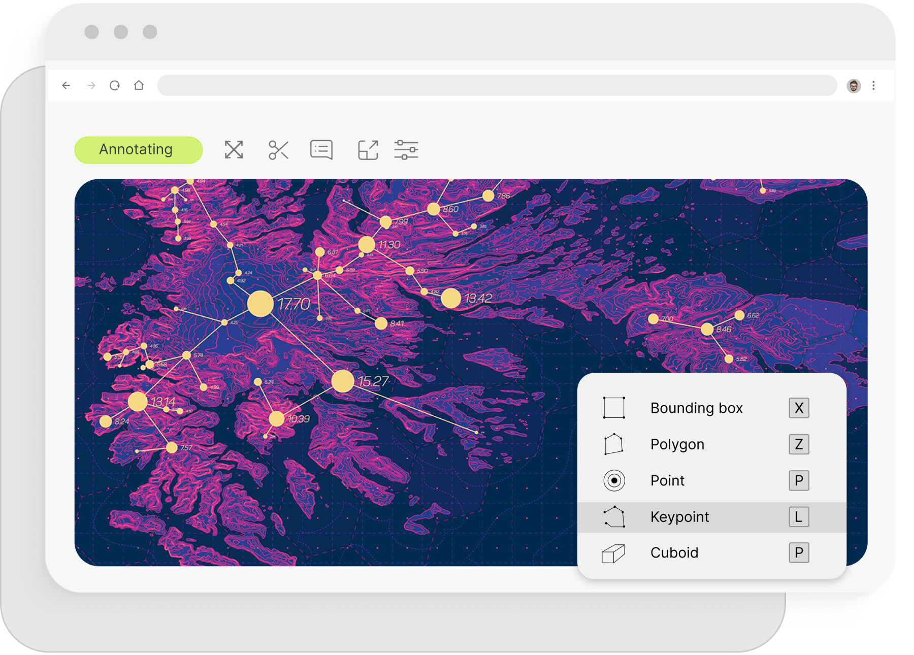
Landmark Annotation
We provide expert landmark annotation services for geospatial data, enabling precise identification of key geographic features in satellite or aerial imagery. Our services enhance AI models used for navigation, urban planning, and environmental monitoring, ensuring accurate recognition and mapping of critical landmarks for improved geospatial analysis.
Industries We Serve


Let’s Collaborate
GET A QUOTEYour Benefits


Our Global Presence
Global recruitment options enable companies to tap into multilingual teams for their Data Annotation for LLM and Customer Support services. Our extensive language services empower businesses to efficiently handle data and convey messages worldwide, transcending cultural and time zone barriers.


Our clients


Guilia M
Anyline, Austria
Thanks to Mindy Support, the client has been able to deliver multiple custom-made mobile OCR scanning solutions on time. They have been thorough and quick to respond with clear communication. Their most impressive feat has been creating solutions within hours.

Dr Henning Lategahn
Atlatec GmbH, Germany
We have been working with Mindy for some time now. They support our teams in Germany with 3D map building work. Their work is invaluable and helps us to deliver on time, within budget, and with quality. They are part of the team now. Thanks, Mindy.

Nick D.
Viu More, Belgium
Thanks to Mindy Support, the client has created an effective model that enables them to differentiate various types of waste. As a result, they've managed to annotate over 1,000 images within two weeks. The team is easy to work with — they're receptive to feedback, personable, and communicative.

Emma Schuster
Sweatcoin, United Kingdom
Mindy Support mastered the role quickly and they meet all of the client's needs. They proactively seek feedback and are very responsive. Exhibiting great project management skills, they provide great service and have an effective workflow. Always available, the team is always on hand if needed.

Antoine S.
Kili Technology
The client has been pleased with Mindy Support's performance. The quality of their annotation and their speed of work have been impressive. Responsive and organized, they facilitate a seamless workflow, which encourages long-term partnership.

Tyler M.
Superb AI
The most impressive aspect of Mindy Support is their ability to combine speed with precision, all while maintaining cost efficiency. Their adeptness at quickly assimilating project requirements and delivering quality annotations within stringent deadlines is commendable and has been instrumental in our projects' success.

Rene Boiler
OnRecruit, Netherlands
In our experience, Mindy Support offers a high return on investment. Many successful meetings with potential clients were won solely on the work they completed. On a personal note, it was a pleasure working with Tetiana and Evgenia, and certainly should we require their expertise in the future, Mindy Support will be the first business we speak to.

Alex C.
YieldSystems
Mindy Support boasted more than 95% accuracy in data annotation, allowing them to flawlessly and efficiently execute their tasks. A dependable partner, they communicated effectively and remained punctual throughout. They provided accurate and cost-effective solutions for the client's software needs.
Let’s Expand with Mindy!
We have a minimum threshold for starting any new project, which is 735 productive man-hours a month (equivalent to 5 graphic annotators working on the task monthly).