3D Point Cloud: What’s the Point?
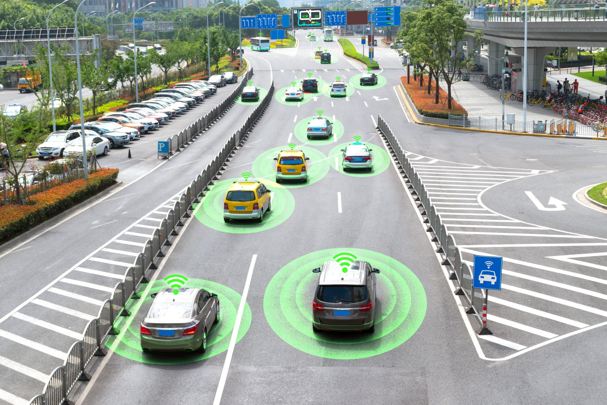
As autonomous vehicles are getting better at navigating their way through traffic and robots are able to identify objects in their surrounding environment we have to wonder: what is the technology that’s making all of this possible? The answer is the 3D point cloud. Let’s take a closer look at what the 3D point cloud is as well as its practical applications.
What is the 3D Point Cloud?
The 3D point cloud is a method of representing the 3D environment using a set of points. Each point will store specific information about the location of an object in the 3D space. For example, points may contain information such as the proximity of a given object in relation to another one, how big or tall the object is and the general proportions and makeup of the object.
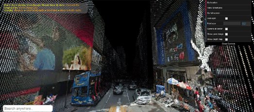
If we take a look at the picture above, it is entirely made out of points which is how self-driving vehicles, robots, and other AI-powered technologies see the physical world. This image simply represents the 2D space with points, but there are more advanced 3D point clouds that offer a depth map. This allows researchers and the technology itself to see an object in 3D meaning it is able to obtain information relating to the distance of the surfaces of scene objects from a viewpoint.
There is another 3D point cloud that uses a semantic heat map. This allows for instance segmentation and 3D bounding box detection. These are all data annotation methods used by researchers to help train ML algorithms to recognize objects in the real world.
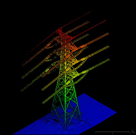
If we take a look at the image of the transmission tower we notice that the ground i.e the lowest point is in blue and the highest point is in red. This is an advanced 3D point cloud mapping method that uses the ROY G BIV method, to display the position of each point in relation to another. The higher the object is located the longer the wavelength will be.
How is a 3D Point Cloud Made?
3D Point Clouds are made with LiDAR, which is a small, circular device attached to a car, drone or any other moving object. For example, when a car drives around town, the attached LiDAR sends out pulses of light and then records how long it takes that light to return. Think of it as the same way bats use to navigate their way around space. They send out soundwaves which produce an echo when they come in contact with an object. Based on this information, the bat knows where the object is in pace. The LiDAR works the same way, but it uses light. All of the readings from the LiDAR are then processed and turned into a 3D Point Cloud.
We should point out that not all point clouds are made with LiDAR. For example, it is possible to make a point cloud with a digital camera which is called photogrammetry. However, LiDAR is the most accurate method of producing a point cloud.
What are the Practical Applications?
We mentioned that the 3D point cloud is used in the automotive industry to create self-driving cars and allow them to navigate their surroundings, but there are many other applications. Point clouds are becoming increasingly used in the construction industry for tracking the progress of an ongoing construction project, geometry quality inspection and even a 3D reconstruction model. It is also used in the agriculture industry for crop monitoring and the creation of robots or machines that can automate the crop management process. As the field of robotics and AI, in general, becomes more advanced, we can start expecting increased usage of the 3D point cloud.
Mindy Support is Assisting Researchers With 3D Point Cloud Annotation
Mindy Support offers comprehensive 3D point cloud annotation services starting with simply labeling all of the objects in the point cloud and object detection with 3D boxes to more advanced annotation such as classifying the objects in the image. We have experience using all kinds of data annotation tools and we are even able to customize them to better suit individual workflows. We have experience in ground truthing for autonomous vehicles, robots, drones, trucks, among others. Contact us today to find out more information.
Posted by Il’ya Dudkin